I know when I started walking beyond Brussels. I’m not sure when it was that I fixed on my destination. Certainly, it was after I began the journey. But soon the paths just seemed to draw me on and on.
If a day now dawns with blue sky and sunshine, or if I hear the clank and whistle of a train on the tracks not far from my house, I feel a yearning for the countryside: muddy ways beside rippling streams, farm tracks by vast open fields, or silent footpaths through thick forests.
During my first decade of living in Brussels, I rarely felt the need to leave the city. One reason might be that I regularly run through the lovely Josephat Park near my home in Schaerbeek. It has its own earth track through a small valley that the Belgian writer and democracy pioneer David Van Reybrouck aptly calls “a miniature Ardennes.”
Otherwise, I often walk to where I need to go, or I pedal on the Villo city bikes, heavy iron donkeys that give good exercise. I once rode a Villo bike the whole way round Brussels, an experience so beset with concrete flyovers that it deterred me from going further. Similarly, the grey, decrepit highways stretching from Brussels to Belgium’s borders are no advertisement for getting to know the country better.
Instead, I satisfied my need for visual variety with the many moments of architectural beauty in the streets that make Brussels such a unique place to live. For an occasional wish to see bigger parks, the ones behind the Africa Museum in Tervuren, around the Atomium or in the Forêt des Soignes (Zoniënwoud) were all that I thought I needed.
So what propelled me to create and then follow a 360 km long trail?
Once, it’s true, I climbed Iran’s Mount Damavand, 5,600m above sea level. More usually, my long-distance walks take place only in my imagination. I fantasise about treks through the mountains of Switzerland. Or Austrian valleys. Or along the coastline of Cornwall. For two decades, I’ve had a house in Turkey right next to the Lycian Way, one of the world’s most beautiful long-distance trails, but even there I rarely went on hikes until recently. Life is busy. Walking any real distance takes time, preparation, and weather that’s not too hot, wet or cold.
In 2025, though, my stars’ alignment changed. I had more time on my hands and the flexibility to do whatever I wanted, whenever the fancy took me. Above all, like many people coming out of full-time employment, I felt the need to create a new sense of mission for myself.
Actually going somewhere
However, I didn’t want to go round neat short circuits, pretty or popular though such walks may be. A long walk that actually went somewhere, perhaps, might give me a goal to be getting on with. Something that I might look forward to with anticipation and look back on with a sense of achievement.
After taking a closer look at Belgium’s excellent network of local train and bus transport, I realised I could inexpensively get a long way from Brussels and back in a day. Done right, a chain of those day-long walks could add up to a real journey.
That way, too, I could choose to walk only when the weather was good.
The idea of trying to walk to a particular place happened like this. One fine day, I wondered if, instead of taking the No. 44 tram to the park in Tervuren just east of Brussels as usual, I could simply walk there. After a close and somewhat suspicious search for footpaths on Google Maps, I rode out to Hermann Dubroux station at the end of Metro Line No. 5, wandered a couple of hundred yards through a flea-market under a fly-over and turned onto the first footpath that I’d found.
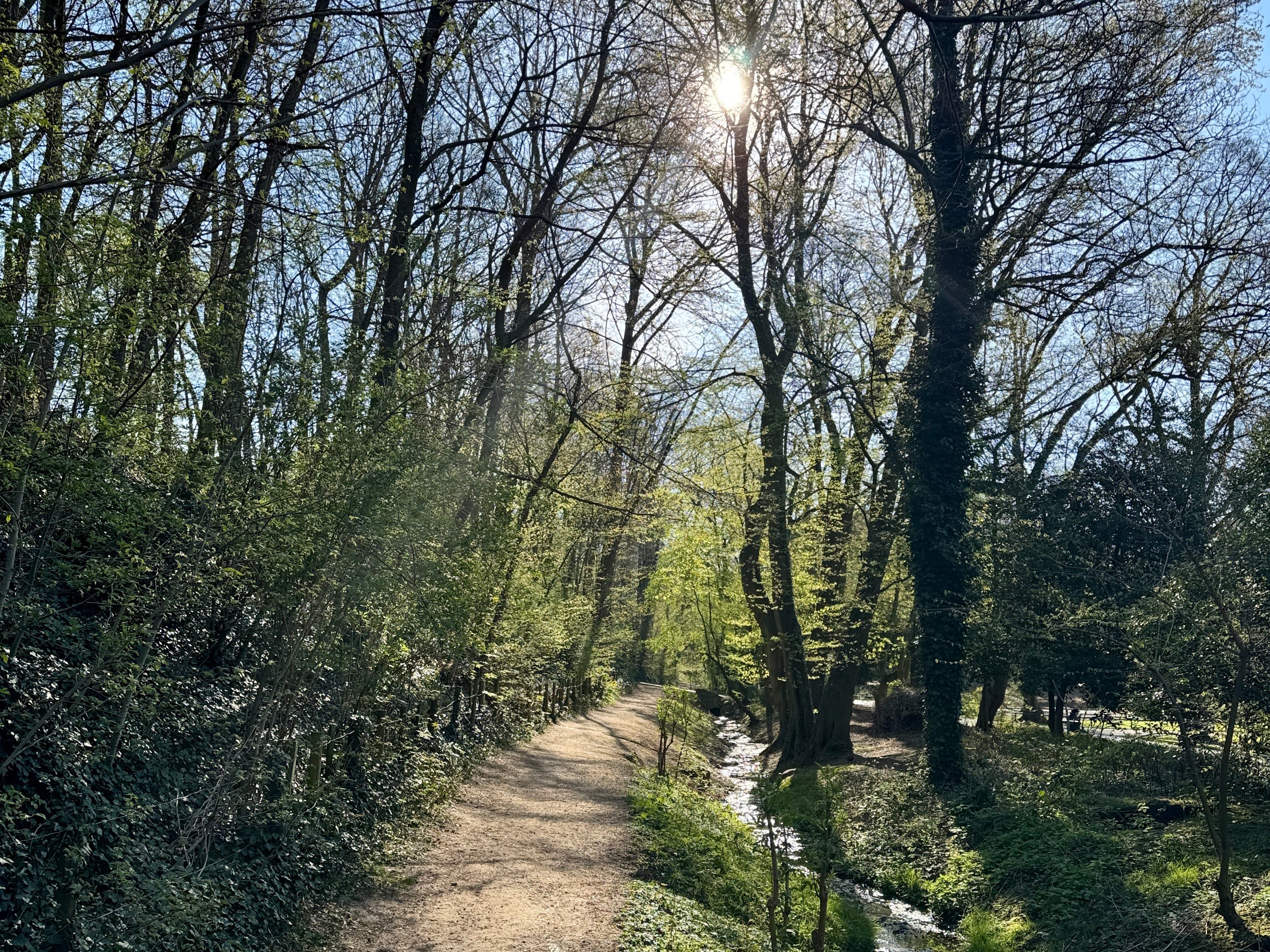
It was like entering another world. I was on a beautiful path leading past streams, trees, meadows and a delightful old cloister complex called Le Clôtre Rouge (Roodklooster). I went on through the Forêt des Soignes (Zoniënwoud). I barely noticed the unsightly Brussels ring road, since I passed under it through a walkers’ tunnel. The rough, muddy glory of the Tervuren Arboretum came next, followed by long, straight paths through alleyways of elegant tall trees. Finally I crossed one road and passed through an ornate back gateway into the magnificent parklands around Tervuren’s Royal Museum of Central Africa.
Crossing that road was the only tarmac I saw all along the 15km hike. I had enjoyed an almost entirely car-free day. I was in heaven.
I did a couple more test routes that lived up to my new hopes: minimal traffic, maximum countryside, few hardened roads, plenty of forest paths and good transport back home.
Belgium’s footpath network
To go further, though, I needed something more than Google Maps. Thanks to the occasional Belgian country walk with my sister Helen, I was aware of the “points-noeud” (knooppunten) signpost system that directs walkers from numbered post to numbered post. Apparently, back in the days when Belgium was a mining superpower, such numbers were how miners found their way around in the dark underground. So someone decided to make them work above ground for the country’s modern superpower cyclists, and then walkers too.
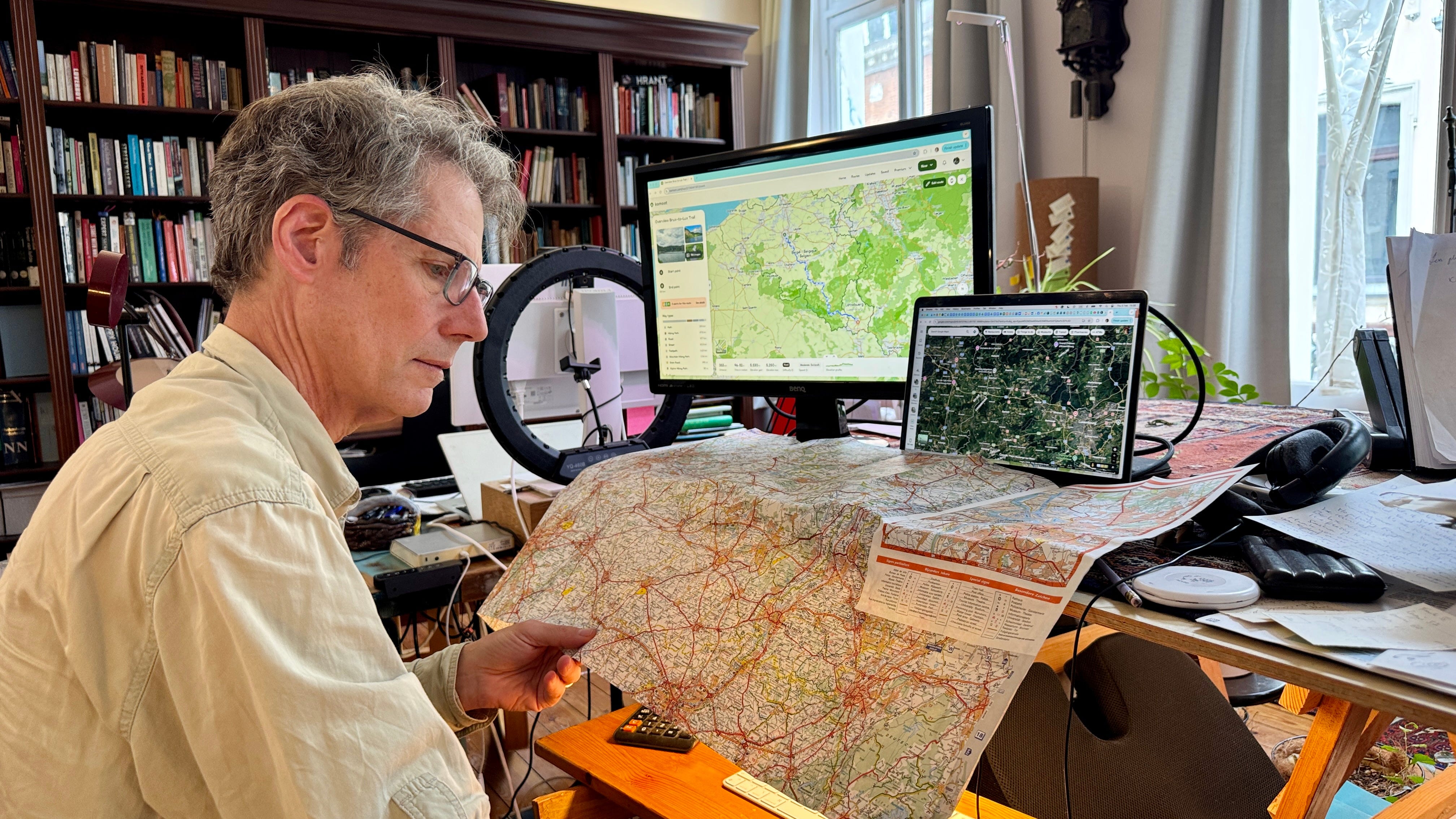
I got serious. I subscribed for a while to the best Belgian app with all the numbers plotted on maps (wandelknooppunt.be). I soon realised it was based on an excellent global resource, OpenStreetMap. I could use the app to go anywhere I wanted to. I started laying out our old paper maps on the dining room table. I checked out the hiking websites of potential way-station towns. I cross-checked with Google’s satellite photos. I even used it to make myself walks while on holiday in far-away places.
But what should my destination be? Germany to the east seemed too vast and too vague. The Netherlands to the north too familiar and flat. France to the south ditto, at least anywhere nearby. I prefer hill country. I wanted to recreate the startlingly beautiful walks my wife Jessica and I stumbled on during a short break we took in Spa, in the eastern part of the Ardennes.
Luxembourg calling
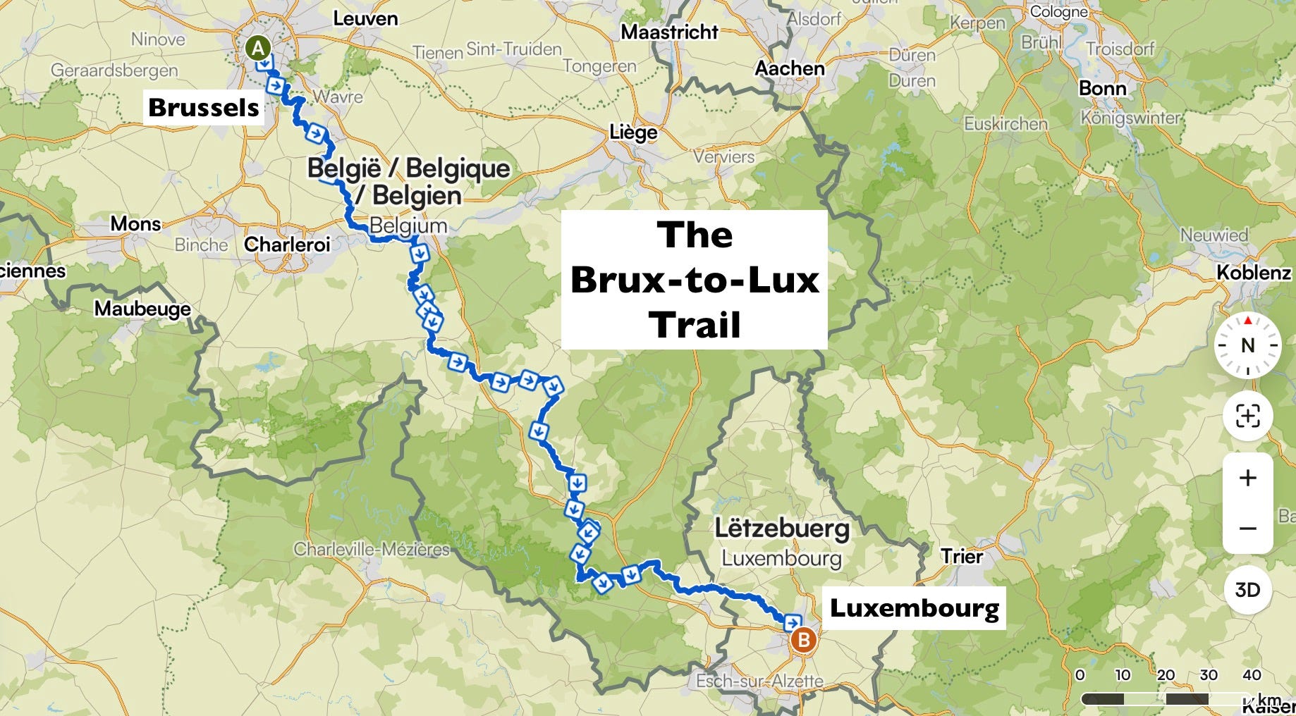
That all seemed to point me southeast, toward Luxembourg. I admit that walking from the capital of the fifth smallest European state to that of the second smallest didn’t at first sound very grand or compelling. But perhaps that’s what got me. I’m a bit of a misfit, and I like nothing better than doing something nobody else can be bothered with.
So Luxembourg slowly grew on me, a mysterious, mediaeval principality that geography and geopolitics often forget, perhaps precisely because it doesn’t seem to be on the way to anywhere. (British television humour immortalised it thus). And, as I wanted to get back to my comfortable home in Brussels after each day stage, another tidbit of information was alluring: the line to Luxembourg, which opened way back in 1850s, has frequent stops. I didn’t know how much public transport I would have to take in Luxembourg, but it sounded nice that, once there, it would be absolutely free.
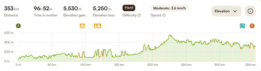
It was surprisingly hard to plan the twenty one-day itineraries that matched my priorities: keeping a good distance away from roads with traffic, avoiding built-up areas, seeking out natural beauty, staying off any tarmac, taking in sites of touristic interest, keeping within 15 km-20 km per day and ending up at a convenient train station so I could get home.
Looking at the map more closely, I realised that heading for Luxembourg meant starting again. My trial stages were taking me too far east, away from convenient railway stations, villages and scenery that I wanted to visit, like the towns of Namur and Dinant, and rivers like the Sambre, Meuse (Maas) and Lesse.
My way-planning skills improved over time. Preparing the route became almost as satisfying as the walk itself. I added the hiking app Komoot to my phone, and became addicted to it. It wan’t just about knowing where I was going. I needed to have good options if I suddenly found a path turning into a road or bumped into a red sign warning that I was heading into private property.
Forests, farms and battlefields
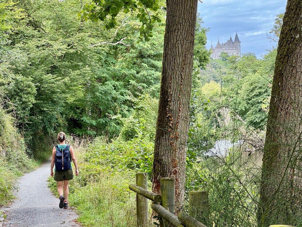
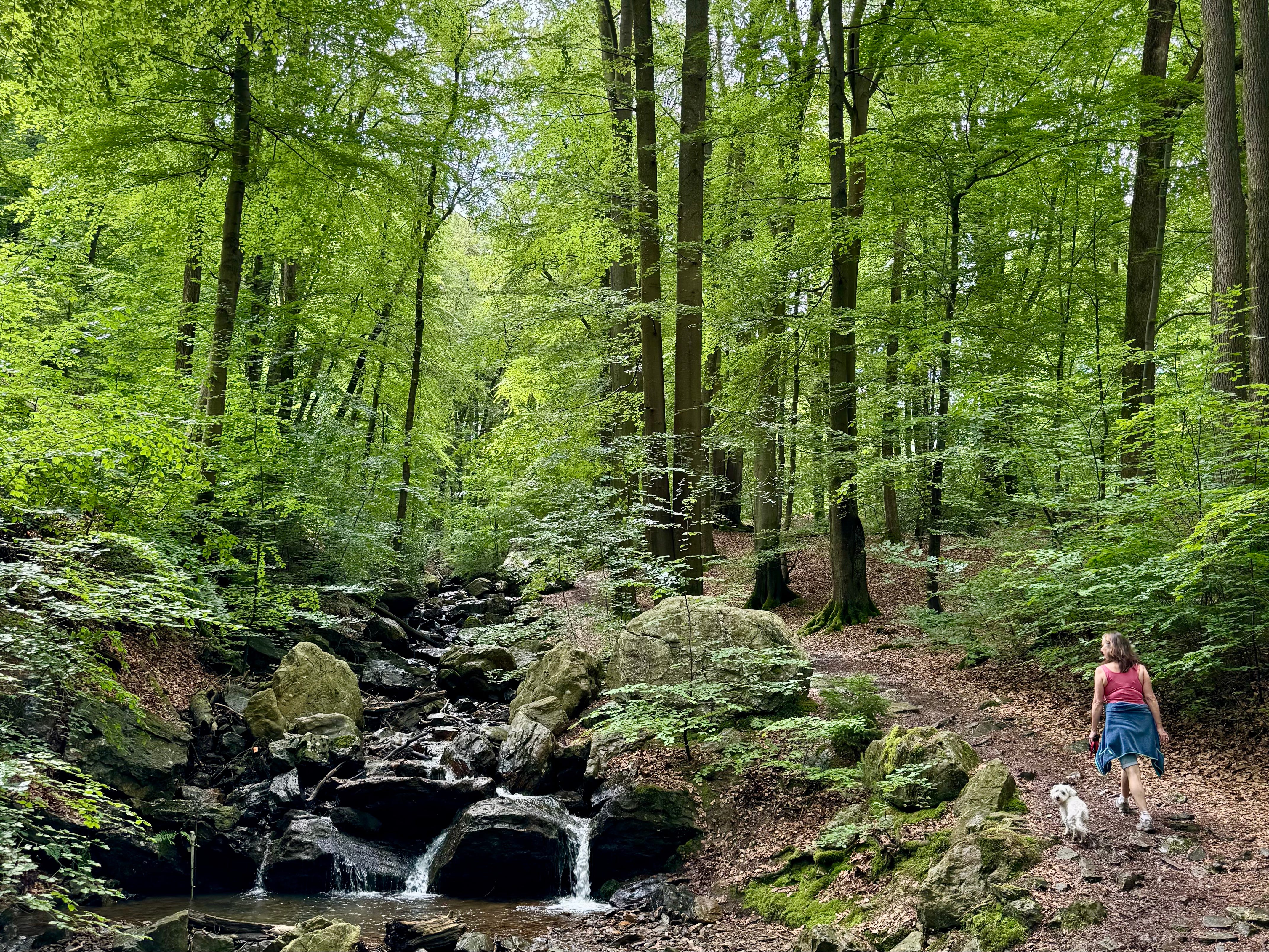
I included wherever I could segments of the existing long-distance trails through southern Belgium. The path goes through great forests, along rivers, across battlefields and past centuries-old farms and castles. There is even the odd Roman road, a few steep climbs (to a heady maximum of 400 metres above sea level), and hundreds of crosses, hermitages, grand abbeys, religious schools, churches and chapels of all descriptions. Having previously seen rural Belgium mostly from its run-down highways, it was a revelation to see how lovely the countryside could be.
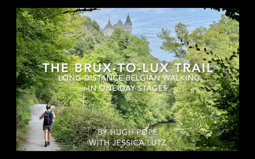
The Brux-to-Lux Trail is a unique interpretation of all these things. It prioritises landscape over speed, wandering for 360 km instead taking the direct 180 km that a crow would fly. It avoids asphalt nearly four-fifths of the way. Any roads are almost all quiet country lanes. And the overall climb of 5,600m is the equivalent of conquering Mount Damavand from sea level – and coming back down again.
I hope you will enjoy trying it out.
+++
I will be sharing the route maps, GPX files, and basic technical information for these walks freely on Substack. You can also follow the routes on my Brux-to-Lux Trail collection on Komoot. There’s a video overview of the route on YouTube here.
If you’ve enjoyed a walk or a piece of writing, you’re very welcome to make a one-off contribution toward trains, maps, and time on the road.
If you’d like to offer closer support, you can also take out a paid subscription on Substack. Alongside the free material, subscribers can:
- submit specific questions about the route or the project
- receive occasional behind-the-scenes posts
- listen to audio recordings of each stage, read by the author

Leave a comment